I’m off to Wales tomorrow morning to look for birds and scenery and photographs. I daresay at some stage I’ll find an internet café or something, but if not, that’s why I’m not posting. Keep your fingers crossed for the weather for me…
Category: Me
Categories
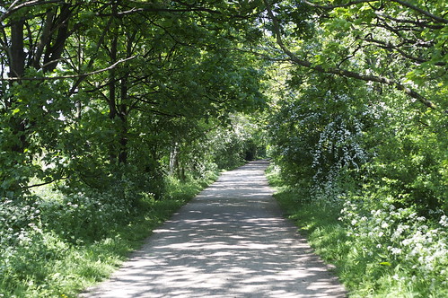
The Thames path, Putney to Kew
And two months later, I get back on the Thames Path again. One exciting addition to the routine: sunscreen. Yup, proper sunny weather; spring turning into summer. And it made for a very pleasant walk; this section of the path feels almost rural. Admittedly, for much of the walk the rurality consists of little more than a few trees and about five feet of weedy verge, but in the full greenness of May, that was pretty good. In November, the impression of being in the countryside would no doubt be a bit weaker.
And if I list some of the plants that were in flower, it certainly sounds rural. Cow parsley, white deadnettle, wild garlic, lady’s smock (cuckooflower), hawthorn, elderflower, forget-me-not; I just love the names. And at this time of the year, everything is so green and full of life: even the sycamores, a tree I basically think of as an exceptionally big ugly weed, looked pretty good.
There were some non-floral points of interest, though. Soon after Putney Bridge, you start walking past the boat houses owned by various schools and rowing clubs, and people rowing on the river. In fact my walk was pretty much the route of the Boat Race. Over the river you can see Craven Cottage, the stadium of Fulham FC, the football club owned by Mohamed “Prince Philip is a Nazi Frankenstein” Al-Fayed. For non-Londoners, Fulham (both the area and the football club) are best defined by the fact that, as much as they’d like to be, they just aren’t Chelsea.
The path here was originally a towpath, I believe. In fact, I think most of the Thames path from here on up to the source of the Thames follows the old towpath: that it, the path used by horses towing the canal boats along the river. I can’t quite imagine the logistics of it: what happened if someone needed to overtake? Or two boats approached from opposite directions? Was the whole river a big cat’s cradle of towropes?
It’s odd to think that, especially before the railways, the canals were the industrial arteries of Britain. They had advantages though: apparently one reason Josiah Wedgwood was a keen investor in canal-building was that, sending his porcelain from Staffordshire to London by road, 30% of it would break on the journey.
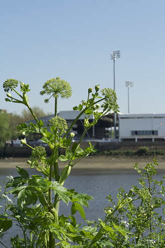
The path goes past a couple of nature reserves. One of them, the London Wetland Centre, describes itself as ‘the best urban site in Europe to watch wildlife’. I don’t know enough about the urban sites in Europe to judge that claim, but they’ve certainly done a really impressive job there. It was built on the site of a water treatment facility, I think, and they’ve created an impressive wetland area. Their headline success, I suppose, has been to attract bitterns in winter, but they also get a variety of waders and ducks, nesting terns, and a colony of sand martins (US: bank swallows). None of which is apparent from the Thames path, it has to be said, except for the sand martins which I watched for a while hunting for insects overhead. These are not sand martins; it’s a crow mobbing a heron.

While I’m writing about birds: it was mostly the usual stuff. Great views of a wren, singing beautifully with its little tail cocked up behind it; good views of a couple of blackcaps, singing even more beautifully and with impressive volume. A couple of exotics: the more unexpected was Egyptian Goose, a bird which is fairly well-established in England but I don’t see that often. No surprise at all to see Ring-necked Parakeets nesting in a tree by the path. They’ve been spreading out from further up the Thames valley for decades now, but in the last four or five years, numbers seem to have exploded: you hear them screeching in any bit of green space in London.
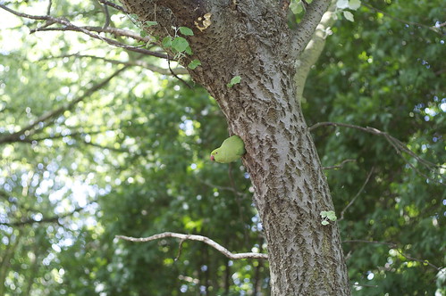
There are two marvellous urban myths about the parakeets. 1) They are all descended from a few birds kept by Jimi Hendrix when he was living in London. 2) They are all descended from parakeets used on the set of The African Queen when it was being filmed at Shepperton Studios. But no special explanation is needed for feral populations of exotic cagebirds — there are loads of them around the world. A couple of years ago, I had to resort to parrot-fancier websites to work out what species I’d seen in a park in Seville.
Rather unusually, the other nature reserve was designed to protect an exotic species: the Two-Lipped Door Snail, which, according to the informative sign, “is thought to have been originally been introduced accidentally by the Romans from mainland Europe, where it is much more common.” I support any excuse for protecting patches of urban woodland, but an exotic species of snail which is common in its native country seems like a low priority. But it has been here for a couple of millennia, so I guess we can grant it honorary native status.
The path also goes past St Paul’s School. When I was on the school bridge team we once played a fixture against the St Paul’s E team. I think it may have been one of the few matches we won, so they can’t have been very good, but the fact the school could field five bridge teams still seems slightly extraordinary. In case you’re interested, I also represented the school at chess and fives. I was pretty rubbish at those too. No killer instinct.
» All these photos and a load of others have been posted to my Flickr account. You can see the whole Thames Path set or just the set for Putney to Kew. I’ve geotagged them so you can see them on a map but to be honest the locations are rather approximate.
Categories
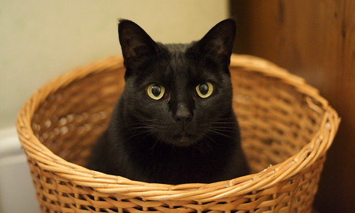
Posy in the wastepaper basket
Watching Chelsea get knocked out of the FA Cup by Barnsley, followed by a big plate of ribs, greens and Hoppin’ John.
My version of soul food wouldn’t pass the Southern Grandmother Authenticity Test, btw, but it was pretty tasty though I do say so myself.
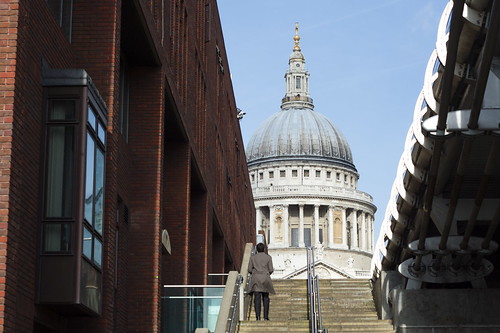
A fairly short chunk of the path; I was intending to go a bit further, but the sun went in and I wasn’t really enjoying it much so I hopped on the tube at Westminster. Still, if you use one of the traditional definitions of a city—a town with a cathedral—this section includes the three medieval cities at the centre of London; it starts by Southwark Cathedral, goes past St Paul’s and ends at Westminster Abbey.
Just to explain that, because I guess not everyone knows the history of London: the royal court and the government was based at Westminster, separated by about a kilometere of fields from London, the mercantile and legal centre where all the law courts and guilds were based. The dynamic between the two is quite interesting, I think: London had a lot of legal autonomy (and indeed money) so even in the days of apparently absolute monarchs the balance of power was less clear cut than you might think. To this day when the Queen goes to St Paul’s for some kind of ceremonial function, her coach stops at the boundaries of the City of London and she asks permission to enter. As a South Londoner it pains me to say it, but Southwark wasn’t really much more than the overflow from London over London Bridge, although because of some kind of legal quirk that meant it wasn’t under the jurisdiction of London it became the centre for bear pits, whorehouses, theatres and similarly disreputable trades. Which is why The Globe was there.
That distinction between the mercantile City of London and Westminster as the seat of government has persisted, of course: we even still refer to ‘The City’ as shorthand for the banking and financial services sector and ‘Westminster’ as shorthand for parliament and government. I find these echoes of the longer history of London interesting because so little physically remains. The Great Fire of 1666 really did burn down nearly the entirety of medieval London. Much of it would no doubt have been knocked down anyway, whether by the Luftwaffe, town planners or commercial developers; but even things like the churches, which might normally offer that kind of continuity, were lost. And most of the Palace of Westminster burnt down in the C19th as well, so that was another major medieval building lost. There are still a few left: Westminster Abbey, Southwark Cathedral, the Tower of London, the Guildhall. But there’s no part of London you can visit and feel you’re in contact with what the city was like. The oldest part of the city is a business district, so it’s all office buildings. All that’s left is the street names: Old Jewry, Cripplegate, Milk Street, London Wall, Blackfriars, Hosier Lane, Carmelite Street.
What’s amazing is that London and Westminster remained separate up until about the mid C18th. So it took about 700 years for London to spread the one kilometre westwards to reach Westminster; but in the next 150 years it spread something like 10 km in all directions.
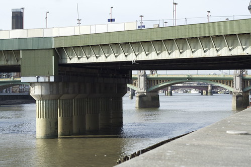
Anyway, you may be wondering why I’m wittering on about the history of London instead of talking about the actual walk. It’s because I didn’t find it very interesting. I decided to walk the north bank because I more often go along the southern side, because of Tate Modern, the South Bank Centre and so on. There quite a few theoretically interesting things to look at: war memorials, the Millennium Bridge, Cleopatra’s Needle, a glimpse of St Paul’s and a couple of the Christopher Wren city churches, as well as views of Tate Modern, Shakespeare’s Globe, the South Bank Centre, the London Eye, the Oxo tower. And just at the end, Big Ben and Portcullis House. But it’s all very familiar; and the path goes past the City and the West End without actually having much contact with them.
It doesn’t help that if you’re walking the north bank in winter, the light is coming from over the river all the time. So everything on the other side of the river was backlit and dificult to photograph; and I really need a wider-angle lens to take pictures of buildings near me.
» Once again I’ve added the pictures to my Thames Path set on Flickr; these ones are tagged with thamespath3.
I picked up the Thames path where I left off, in Greenwich, and crossed straight under the river to the Isle of Dogs. The Greenwich foot tunnel itself is kind of freaky; I’m not normally susceptible to claustrophobia, but I got a definite twinge here. I took the stairs down, which made me conscious of how deep underground it was; and then the tunnel is quite narrow, and feels surprisingly long. And if you start thinking too much about the mass of the Thames sitting above you…
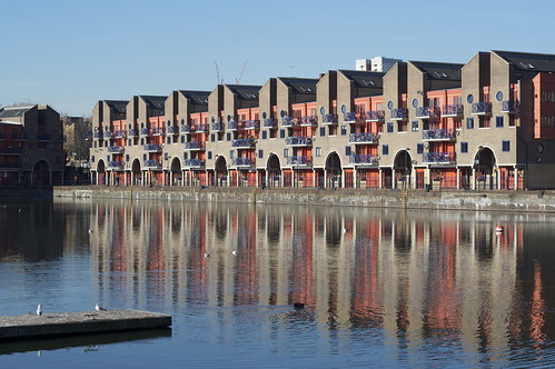
Anyway, the Idle of Dogs [sorry, that’s a typo, but it would make a good title for something, don’t you think?]. I mentioned that during the last section there were occasional outcrops of upmarket apartment blocks among the industrial landscape. As far as you can tell from the Thames path, on the Isle of Dogs that process is now complete. The riverfront is almost completely residential for this section of the walk. And the exceptions are offices rather than industry. It’s a dramatic change, since this was once one of the greatest trading centres in the world. The docks are still there, huge stretches of water now serving as watersport centres, or marinas, or just gigantic decorative water features; and many of the wharves and factories have been adapted into apartments and offices. But it’s remarkable how little these physical traces of the past give any sense of what it must have been like. In the absence of noise and smell and dirt, with no real traffic on the river, the old hoists that have been left on the sides of converted warehouses just seem like some peculiar local architectural vernacular: steampunk genteel.

The buildings I found most attractive were those which seemed to have an intimacy with the river. That usually meant converted wharves. Not just because they’d had the chance to weather and age into the landscape, but because they’d been built right up on the river, overhanging the water. The new-built apartment blocks are quite different. In some ways, the river is the reason for their existence; they were built where they were because the developers know people will pay good money for a river view. But it’s a view. The river is something they look over and look across. It could be anything; as it happens, it’s a river. The apartment blocks don’t even have a relationship with each other; the Thames Path regularly has to leave the river to skirt around buildings not because they are physically blocking the way, but because they have big walls and fences covered in private property signs. I understand the desire for security, but there’s something faintly depressing about a whole row of apartment blocks all treating each other as the enemy.
Just occasionally you find a corner that gives you an idea of what this part of London could have been like: a city on the water, a kind of Venice with docks replacing the canals. Perhaps Venice is a bit optimistic, but the redevelopment of a whole area of London has to be an opportunity to do something remarkable; on the whole that opportunity has been wasted. Not that the area is a disaster; hell, I wouldn’t mind one of those apartments with a view of the river for myself. But it’s not a triumph, either.
The most striking collision of architecture and the water is Canary Wharf, where from the right angles, the skyscrapers seem to rise out of sheets of water. Which is spectacular, in a 60s-vision-of-the-future sort of way. I remember when it was just the Canary Wharf Tower standing alone, then the tallest building in Europe, towering over the area. It had only just been completed when the property market collapsed, and it stood half-empty for a long time. You used to be able to see it from all over south London. In the post-binge guilt of the early 90s, it seemed like a visible symbol of the greed and hubris of the 80s. Now, with Canary Wharf a major centre for London’s financial industry, and a whole rash of big new tower blocks planned for London, that original building seems ahead of its time; visionary, almost. Timing is everything. Since it looks like we’re about to have a serious economic downturn, the builders of all those new super tall skyscrapers may that find out the hard way.
After lunch, I went down to rejoin the river and was startled to find myself looking at Tower Bridge. You wouldn’t think something like that could creep up on you, but the geography of the river is such that I hadn’t seen even a partial view of it until going round the bend in the river at Wapping. And next to Tower Bridge, the Tower of London. Just as it’s hard to get a sense of the industrial past of the Isle of Dogs, it’s hard to think of the Tower as a military installation and prison. I believe the tour guides do their best to play up the gorier elements of the Tower’s history, but on a day with the sun shining on the honey-coloured stone walls and tourists wandering aimlessly around, it’s hard to think of the building as the Lubianka of medieval and Tudor London. Tower Bridge doesn’t help. I think I’ve mentioned before how odd I find the juxtaposition; the genuinely medieval Tower right up against the Victorian medieval pastiche.
It says something about the self-confidence of the Victorians that they built the bridge there at all; the Tower is one of the most historically important buildings in the country, and the bridge is right up against it, looming over it. The Gothic styling on a cutting-edge piece of engineering just adds to the intrigue. I’d love to know what the planners thought they were doing. Did they think that it would make the bridge complement the Tower? Or were they just following the fashion of the moment? If they did intend it to be a sympathetic piece of design, I think they failed. The two are too close, too much in competition. It almost feels like the bridge is poking fun at the Tower. Don’t get me wrong, I think that Tower Bridge is a fabulous construction. It’s the complete opposite of a purist’s bridge. I think bridge aficionados typically enjoy a kind of engineering aesthetic, where the beauty arises from the structure; the builders of Tower Bridge clearly had no time for such asceticism. And the result is slightly bonkers. In fact I think it’s only familiarity that stops us from seeing how bonkers it is; but it didn’t become one of the most easily recognisable bridges in the world by being normal.
» Once again, these photos and others are posted to my Thames Path set on Flickr. I’ve tagged all the ones taken on this section with thamespath2.